Site Inspections
Perth Cadcentre was recently commissioned to provide As Construction drawings of the new roofs installed on an existing building complex.
The traditional method to provide this information would have been to site measure each roof by hand. Not only would this have been very time consuming but also dangerous, and also prone to error.
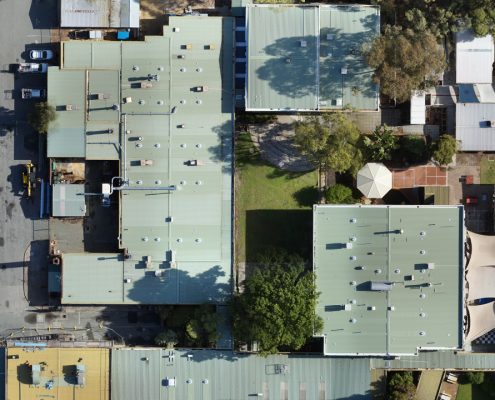
Our sister company Perth Drone Centre carried out an aerial survey of the entire site. An orthomosaic image of the site was then produced using Pix4d software, this was geospatially corrected to an accuracy of 2 – 2.5cm using Ground Control Points and Rinex data.
The orthomosaic image was then imported into Autocad and the existing CAD files that were supplied by the client were updated to match this image. The final results were 100% accurate “As Constructed” drawings.
The project was delivered ahead of time and under budget.
This is one of many ways in which aerial surveys can assist in maintaining accurate Site / Asset information


